
Boston: America’s Walking City – Part 2

After all the good Mexican food I ate at Border café the previous night, I was hyped to continue my adventures in Boston; starting with the Freedom Trail. Let’s go, shall we?
DAY 2
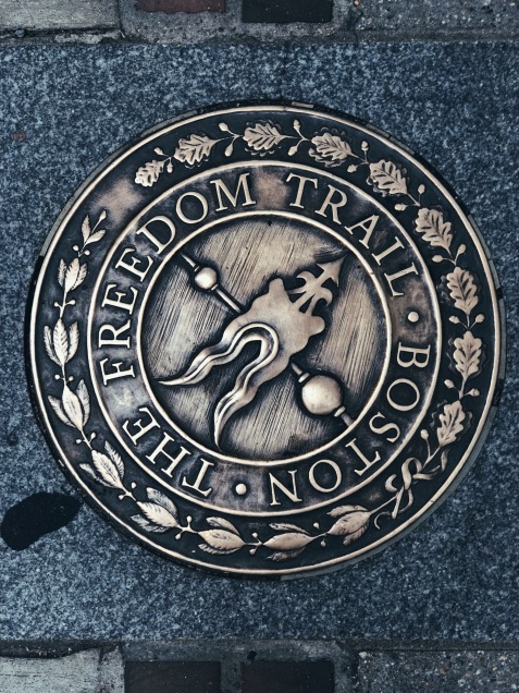
The Freedom Trail
The Freedom Trail is a 2.5 mile (4 km) path that takes you through all the historic sites of Boston. Knowing the distance I would have to walk and the time I would need, I decided to give the trail an entire day with some time to spare to go to MIT. Following are the spots on the trail and how it looks like:
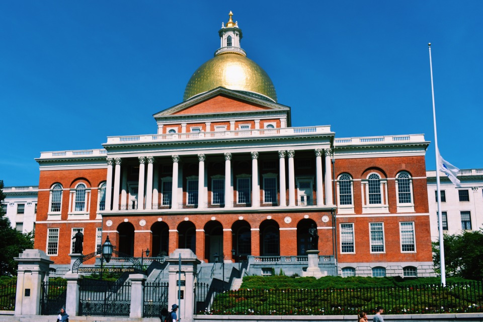
Massachusetts State House
Now, there were some more places that I wanted to see which were a few blocks away from the trail. I marked those in my map along with the trail spots in a way that I could deviate away from the trail, see those spots and then come back on track.
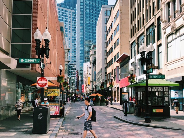
Downtown Crossing: The Meeting of Summer St and Winter St
After visiting the Park Street Church and the graveyard, I went away from the trail to see Downtown Crossing. An interesting thing about this place is that there’s a spot where the following two streets meet – Winter Street and Summer Street. I then went ahead and walked over to a street named Greenway which is known for the art and sculptures built on it. I saw the Chinatown Gate which is a symbolic entrance to the China town in Boston and then walked over to Boston Harbor. You’ve heard about the Boston Tea Party, right? The Boston Tea Party Museum is at Boston Harbor! I didn’t really have the time to go in but if you’re with your family, I’ve heard that it’s a good experience to have!
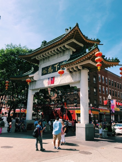
Chinatown Gate
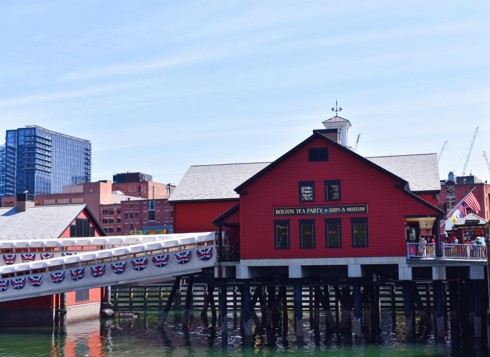
Boston Tea Party Museum at Boston Harbor
I was making my way back to the trail when I spotted Norman B. Leventhal Park. It had an archway covered with plants and a refreshing water fountain.
Boston Tall Ships

Archway at the Christopher Columbus Park
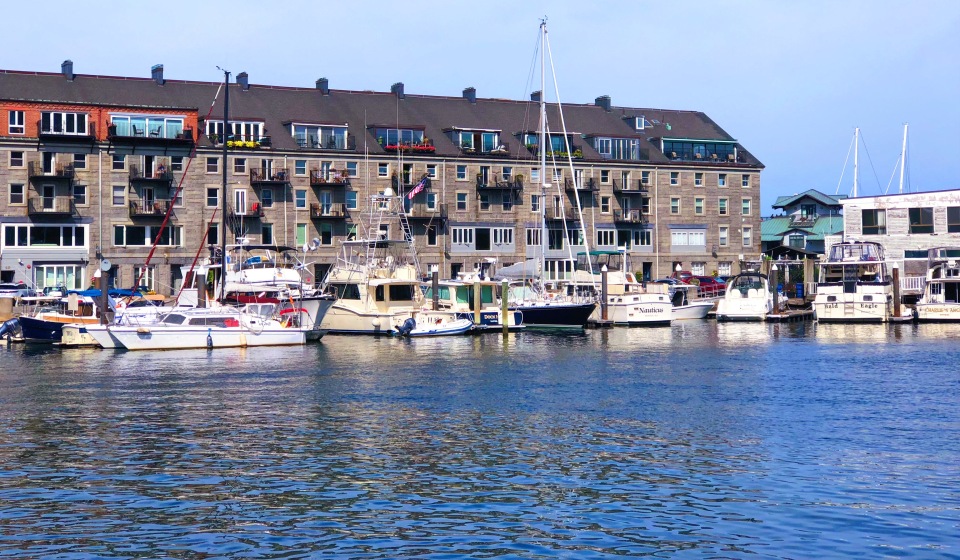
When I was approaching the North End of Boston, I deviated away from the trail to go see the Christopher Columbus Park and the Boston Tall Ships. The park is beautiful but very crowded. The view of the Tall Ships on the pristine blue water was stunning!
I MADE IT! I sat down at one of the parks at the end of the trail and massaged my feet so you can imagine how badly they were aching.
Massachusetts Institute of Technology (MIT)
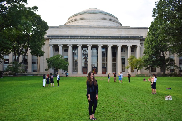
The Freedom Trail is EXHAUSTING. After covering all the spots on the Freedom Trail Map, I went to the Massachusetts Institute of Technology (MIT); another highly reputed school that’s a dream for quite some people. Even though I got down from the cab on the wrong side of the school, I got to walk through the halls of the school to get to the backyard! Here’s a picture of me fangirling inside the school because that’s the closest I can get to being in there for now! 😛 The backyard is beautiful and gives a good view of the school and the Charles River. I sat down on the grass, soaking up some sun and just admiring the view.
I went over to see the Charles River and then decided to call it a day – actually, my feet did.
DAY 3
After all that walking from the first two days, my feet were crying. So, just to make them (and my mind) happy, I started this day a bit later than the first two. If you happen to notice, breakfast/brunch is my favorite meal to have, outside the house. There I was, at Flour Bakery, ordering my breakfast sandwich with a cookie.
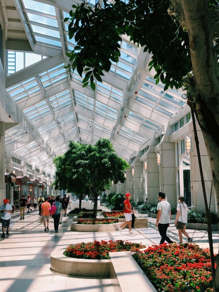
Prudential Center
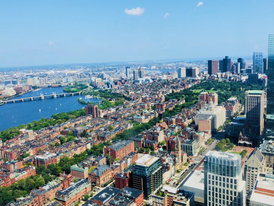
View from the 51st Floor of the Skywalk Observatory
After having a scrumptious brunch there, I headed towards Boston’s world-famous Skywalk Observatory. Now, when I searched for it on Google Maps, it told me to go to the Prudential Center. After being in the Prudential Center for 10 minutes, I asked the help desk for directions, and guess what – the entrance is inside the mall. 😐 Well, someone should put that on Google Maps! The observatory lets you go up till the 51st floor and offers a 360-degree view of Boston. Despite going on a holiday, this place wasn’t crowded at all. It’s not that great though; maybe worth skipping it!
As it was almost time for me to make my way to the airport, I went back to Cambridge by train, grabbed my luggage and booked a cab for the airport.
Things to keep in mind:
- While picking a place to stay, look at the time it would take you to get to all the places in your list, the locality, and the cost. Boston is expensive, in general.
- Generally speaking, Google Maps doesn’t work accurately in Boston. Ask around immediately if you’re confused.
- There’s a lot of walking involved in this city so pack your most comfortable shoes!
- If you’re traveling by Uber/Lyft, double-check the destination pin in the app before booking as they might end up dropping you on the wrong side of your destination. It happened with me a couple of times.
- A fascinating aspect about the Freedom Trail is that there are red bricks on the footpath which depict the trail. You can basically follow the bricks and not even look at Google/Apple Maps as they will guide you throughout the trail! Interesting, right?
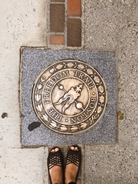
Red Bricks on the Freedom Trail
I was genuinely sad to leave this place and I don’t say that about a lot of places. I’m sure I’ll go back to this wonderful city that gave me so many memories, delicious food, and Instagrammable pictures! 😛

Nicely narrated.👍👍
LikeLiked by 1 person
Thank you, Aai! 😀
LikeLike
Suburbly written Ishita
LikeLiked by 1 person
Thank you, Nini! 😀
LikeLike
Amazing photos😍. Love the idea of pinning the map.
LikeLiked by 1 person
Thank you! Glad you liked it. 😀
LikeLike